

Prevent catastrophic wildfires from spark to spread.
Introducing a new first line of defense in wildfire resilience.
Most catastrophic wildfires start where vegetation meets power lines. An asset may spark for many reasons, but those sparks only turn into wildfires when they ignite and spread. Controlling that risk in the 10 meters around a utility asset is the most effective way to prevent a fire from spreading.
Today’s utility teams need to know where fires are most likely to spark and spread to plan efficient mitigation work and keep their communities safe. See how it works in the demo below.
Control the spark before it spreads
Pinpoint where tree risk meets ignition risk
Our wildfire intelligence is the first comprehensive analysis to combine tree risk with fuel risk across thousands of miles of utility networks. By understanding where fires are most likely to spark and spread, they can plan mitigation work efficiently. With this precision, utilities can invest their limited resources with confidence, focusing on the parts of the grid that matter most.
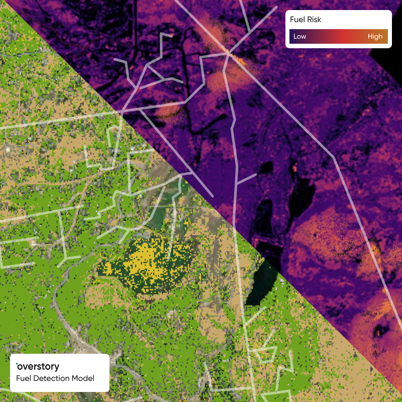
Powered by Overstory’s Fuel Detection Model
At right-of-way scale
Identifies the fuels directly in your right-of-way — where they may spread fires — at 10,000x higher resolution than public maps. Only at this scale can utilities pinpoint the exact spans, assets, and actions needed to prevent wildfires.
Routinely updated
Refreshed with standard imagery capture cycles, this keeps pace with vegetation growth year over year. Because wildfire risk shifts quickly, this enables teams to prioritize mitigation strategies around real on-the-ground conditions—not last year’s data.
Established science
Built on established fuel types and fire behavior validated by scientists. Grounded in the same science used by fire agencies, and enhanced by Overstory’s AI-powered vegetation intelligence.
How utilities are putting it to work

Plan vegetation work
Target spans with hazard or fall-in risk trees most likely to contact, ignite, and spread.

Prioritize asset maintenance
Inform asset maintenance or replacements based on highest spread risk

Reduce fuels
Identify areas within and beyond the right-of-way that need clearing and plan appropriate work.